

A closer look at Admiralty Arch.

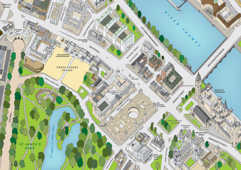
This illustration uses simple flat colours and a soft shadow effect to hint at the direction of the sunlight. This helps to add a degree of realism.
Westminster
This is a hand-drawn map illustration which has subsequently been digitised and coloured. Showing central Westminster, this map includes the Houses of Parliament, Westminster Abbey, St James's Park, Whitehall and Westminster Bridge.
In the context of mapping the urban environment, graphics in this format, which employ illustrative features like this one, are particularly useful for tourist guides. It's much easier, if the map reader is not familiar with an area, to navigate using buildings and other features as reference points, if the façades are shown (in comparison with a typical two-dimensional plan where they are not).

A section of the illustration, around Parliament Square, shown in greater detail.
The widths of the streets have been significantly exaggerated in this illustration to avoid creating too much 'dead ground' behind the 3D buildings. This illustration has been constructed using a 'plan oblique' approach. This ensures that the street names still appear to sit in the same plane as the rest of the map without needing to be skewed.