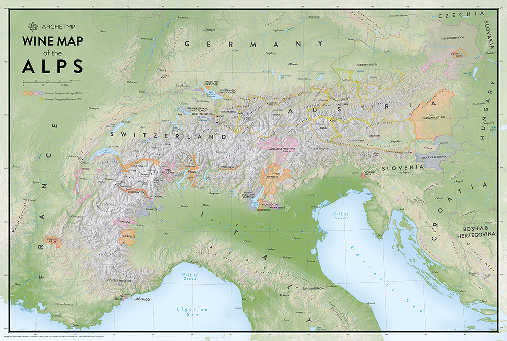
An overview map, produced for Archetyp, highlighting wine growing regions in the Alps.

Archetyp Wine Map of the Alps

A map highlighting wine growing regions in the Alps.

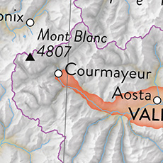
The topographical shading used on this map shown in greater detail.

The topographical shading used on this map, shown in greater detail.
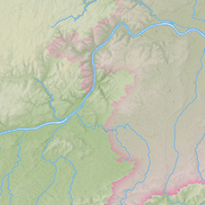
We've used subtle, graduated fills to highlight the regions PDOs and PGIs.

We've used subtle, graduated fills to highlight the regions PDOs and PGIs.

Archetyp Wine Map of the Alps

Client: Archetyp

A large format map, produced for Archetyp, highlighting wine growing regions in the Alps. This map features the Alps' PDO (Protected Designation of Origin) areas and PGI (Protected Geographical Indication) regions.

Archetyp were keen to utilise a topographic map as the basis for this product, referencing this map of the Alps in their briefing documents. There was a desire for the reader to have a clear view of the terrain, including the transition zones where steep slopes give way to flatter areas. In order to facilitate this and to emphasise the impressive Alpine terrain, we modelled the terrain using 3D software, which results in a more impressive visual outcome compared to other methods of production. We worked with Archetyp’s branding guidelines to create a product that fits in with their other products and merchandise.

This map has been designed for print and is currently available to purchase as a limited edition fine art print, via Archetyp’s website.

Map data © OpenStreetMap contributors. Data available under the Open Data Commons Open Database License (ODbL). https://www.openstreetmap.org/copyright.

Ed Merritt
View Ed Merritt's profile on LinkedIn

About

Hello, my name is Ed Merritt. I am a cartographer based in Southampton (UK). I established Merritt Cartographic in 2006.

I am a graduate of Oxford Brookes University, receiving an honours degree in Mapping and Cartography. Having worked in the past for a large publishing company in central London, much of my current work is commissioned for inclusion in reference books. I also produce interactive maps for deployment on websites and in applications as well as products for use on public display panels and signposts. As a freelance cartographer, I have produced custom maps and graphics for a wide range of publishers, charities, media organisations and businesses. My work has been included in books published by Dorling Kindersley, National Geographic, Pearson, Penguin Books, Oxford University Press, Taschen, Laurence King Publishing, Millennium House and Weldon Owen. I've also created maps for a wide range of other companies and charities, including the Royal Horticultural Society, Smithsonian Institution, Best Western, The Greenbrier Companies, Fastmarkets, Bright Horizons, London & Partners and Cycling UK.

I enjoy being creative in my work and like to explore new approaches. As a map-maker, I have a natural tendency to pay attention to detail and also to work hard to ensure that I am being as accurate as I can in the work that I produce.

For more information on how Merritt Cartographic can best assist you with your project, please send me a message or make contact via the information displayed above and throughout the site. I look forward to hearing from you.

Information Button
Exit Button
Phone: +44 (0)7843 978646